 vesseltracker.com
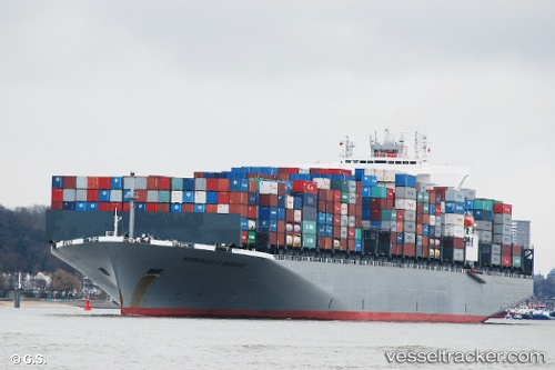
 Honolulu Bridge
Current Status
Where is the vessel?
Honolulu Bridge is currently in 10 nm S of ZHOUSHAN, based on AIS data received about 447d ago.
Latest AIS update:
Current position: 29.79817° N, 122.16603° E (10 nm S of ZHOUSHAN)
Average speed (last 7 days): Loading…
Average speed (last 30 days): Loading…
Vessel profile: Honolulu Bridge is a Container Ship with dimensions 335m x 336m.
This page combines live AIS, route history, probable destination signals, nearby traffic, and port activity for practical vessel monitoring.
The current position of vessel Honolulu Bridge is 29.79817 lat / 122.16603 lng. Updated: 2025-02-05 04:58:09 UTCNearest reference points:
- 10 nm SE of Daxie Pt
- 11 nm S of ZHOUSHAN
- Near ZHOUSHAN
Currently sailing under the flag of Panama ![]()
Honolulu Bridge built in 2012 year
Deadweight:
96980 tDetails:
Live Vessel Honolulu Bridge Analytics (details, animations, etc.)
Recent AIS points (UTC):
2025-02-05 04:58:09 UTC · 29.79817, 122.16603 · SOG 0 kn · COG 253°