 vesseltracker.com
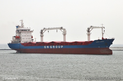
Vessel Lady Leyla IMO: 9106986, MMSI: 374861000 Multi Purpose Carrier
UTC, 45.58042, 13.69210, course: 92, speed: 0.2
UTC, 45.58103, 13.69236, course: 123, speed: 0
2026-01-17 03:54:38 UTC, 45.58116, 13.69249, course: 138, speed: 0
Live AIS position:
UTC. Near Koper),
updated 2026-01-17 03:54:38 UTC.
Find the position of the vessel Lady Leyla on the map. The latter are known coordinates and path.
marine traffic ship tracker show on live map
The current position of vessel Lady Leyla is 45.58116 lat / 13.69249 lng. Updated: 2026-01-17 03:54:38 UTCCurrently sailing under the flag of Panama
Lady Leyla built in 1995 year
Deadweight:
11366 tDetails:
Last coordinates of the vessel:
UTC, 45.57986, 13.69514, course: 305, speed: 0UTC, 45.58042, 13.69210, course: 92, speed: 0.2
UTC, 45.58103, 13.69236, course: 123, speed: 0
2026-01-17 03:54:38 UTC, 45.58116, 13.69249, course: 138, speed: 0