 vesseltracker.com
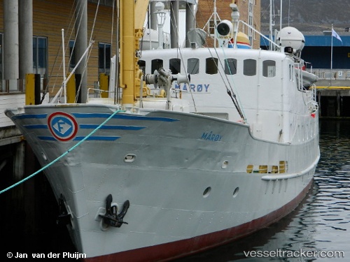
 Gamle Maroy
Current Status
Where is the vessel?
Gamle Maroy is currently in Near HAVOYSUND, based on AIS data received about 2d ago.
Latest AIS update:
Current position: 70.99435° N, 24.65518° E (Near HAVOYSUND)
Average speed (last 7 days): Loading…
Average speed (last 30 days): Loading…
Vessel profile: Gamle Maroy is a Passenger General Cargo Ship with dimensions 34m x 7m.
This page combines live AIS, route history, probable destination signals, nearby traffic, and port activity for practical vessel monitoring.
The current position of vessel Gamle Maroy is 70.99435 lat / 24.65518 lng. Updated: 2026-04-07 14:24:09 UTCNearest reference points:
- Near Repparfjord
- Near Hammerfest
- Near RYPEFJORD
Currently sailing under the flag of Norway ![]()
Gamle Maroy built in 1959 year
Details:
Live Vessel Gamle Maroy Analytics (details, animations, etc.)
Recent AIS points (UTC):
2026-04-07 14:24:09 UTC · 70.99435, 24.65518 · SOG 0 kn · COG 297°2026-04-07 14:24:09 UTC · 70.99435, 24.65518 · SOG 0 kn · COG 297°
2026-04-07 14:24:09 UTC · 70.99435, 24.65518 · SOG 0 kn · COG 297°
2026-04-07 14:24:09 UTC · 70.99435, 24.65518 · SOG 0 kn · COG 297°