 vesseltracker.com
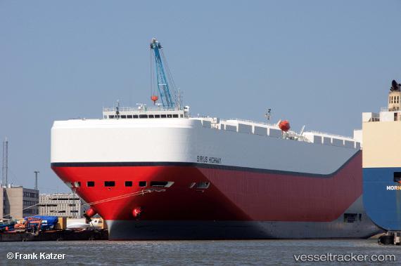
 Sirius Highway
Current Status
Where is the vessel?
Sirius Highway is currently in 54 nm SW of Ust-Kamchatsk, based on AIS data received less than 1h ago.
Latest AIS update:
Current position: 49.69416° N, 161.50468° E (54 nm SW of Ust-Kamchatsk)
Average speed (last 7 days): Loading…
Average speed (last 30 days): Loading…
Vessel profile: Sirius Highway is a Vehicles Carrier with dimensions 199m x 199m.
This page combines live AIS, route history, probable destination signals, nearby traffic, and port activity for practical vessel monitoring.
The current position of vessel Sirius Highway is 49.69416 lat / 161.50468 lng. Updated: 2026-04-26 17:40:00 UTCCurrently sailing under the flag of Marshall Is ![]()
Details:
Live Vessel Sirius Highway Analytics (details, animations, etc.)
Recent AIS points (UTC):
2026-04-26 13:33:02 UTC · 50.22667, 162.82500 · SOG 15 kn · COG -1°2026-04-26 15:30:01 UTC · 49.96500, 162.17500 · SOG 14 kn · COG -1°
2026-04-26 16:15:01 UTC · 49.87167, 161.94167 · SOG 14 kn · COG -1°
2026-04-26 17:40:00 UTC · 49.69416, 161.50468 · SOG 14.2 kn · COG 241°