 vesseltracker.com
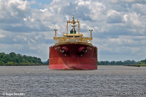
 VELOS TOPAZ
Current Status
Where is the vessel?
VELOS TOPAZ is currently in 26 nm SW of Montevideo, based on AIS data received about 28d ago.
Latest AIS update:
Current position: 35.16882° S, 56.65834° W (26 nm SW of Montevideo)
Average speed (last 7 days): Loading…
Average speed (last 30 days): Loading…
Vessel profile: VELOS TOPAZ is a Chemical/Oil Products Tanker with dimensions 28m x 182m.
This page combines live AIS, route history, probable destination signals, nearby traffic, and port activity for practical vessel monitoring.
The current position of vessel VELOS TOPAZ is -35.16882 lat / -56.65834 lng. Updated: 2026-03-19 08:25:45 UTCNearest reference points:
- 16 nm N of Cabo San Antonio
- Near JUAN LACAZE
- 12 nm S of Piriápolis
Currently sailing under the flag of Marshall Islands ![]()
VELOS TOPAZ built in 2007 year
Deadweight:
39808 tDetails:
Live Vessel VELOS TOPAZ Analytics (details, animations, etc.)
Recent AIS points (UTC):
2026-03-19 08:25:45 UTC · -35.16882, -56.65834 · SOG 9.2 kn · COG 86°