 vesseltracker.com
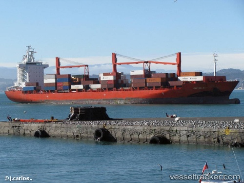
 Alianca Manaus
Current Status
Where is the vessel?
Alianca Manaus is currently in 112 nm W of Ankokoambo, based on AIS data received about 1h ago.
Latest AIS update:
Current position: 16.35167° S, 42.53833° E (112 nm W of Ankokoambo)
Average speed (last 7 days): Loading…
Average speed (last 30 days): Loading…
Vessel profile: Alianca Manaus is a Container Ship with dimensions 208m x 30m.
This page combines live AIS, route history, probable destination signals, nearby traffic, and port activity for practical vessel monitoring.
The current position of vessel Alianca Manaus is -16.35167 lat / 42.53833 lng. Updated: 2026-04-30 17:45:34 UTCNearest reference points:
- Near NACALA PORTO
- 10 nm N of NACALA PORTO
Currently sailing under the flag of Singapore ![]()
Alianca Manaus built in 2004 year
Deadweight:
33925 tDetails:
Live Vessel Alianca Manaus Analytics (details, animations, etc.)
Recent AIS points (UTC):
2026-04-30 13:46:16 UTC · -16.77153, 41.93392 · SOG 10.8 kn · COG 35°2026-04-30 15:54:44 UTC · -16.52710, 42.24283 · SOG 10.7 kn · COG 58°
2026-04-30 16:33:32 UTC · -16.46333, 42.34500 · SOG 11 kn · COG -1°
2026-04-30 17:45:34 UTC · -16.35167, 42.53833 · SOG 11 kn · COG -1°