 vesseltracker.com
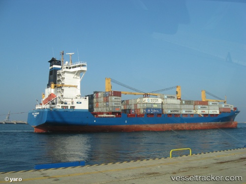
Vessel Helle Ritscher IMO: 9333371, MMSI: 636091030 Container Ship
UTC, 51.87971, 4.39809, course: 83, speed: 0
UTC, 51.87971, 4.39810, course: 83, speed: 0
2026-01-13 17:31:10 UTC, 51.87970, 4.39810, course: 83, speed: 0
Live AIS position:
UTC. Near ROTTERDAM PERNIS),
updated 2026-01-13 17:31:10 UTC.
Find the position of the vessel Helle Ritscher on the map. The latter are known coordinates and path.
marine traffic ship tracker show on live map
The current position of vessel Helle Ritscher is 51.87970 lat / 4.39810 lng. Updated: 2026-01-13 17:31:10 UTCCurrently sailing under the flag of Liberia
Helle Ritscher built in 2006 year
Deadweight:
22254 tDetails:
Last coordinates of the vessel:
UTC, 51.87970, 4.39809, course: 83, speed: 0UTC, 51.87971, 4.39809, course: 83, speed: 0
UTC, 51.87971, 4.39810, course: 83, speed: 0
2026-01-13 17:31:10 UTC, 51.87970, 4.39810, course: 83, speed: 0