 vesseltracker.com
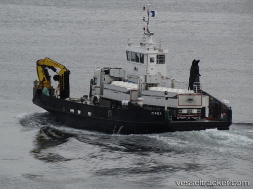
 Samba
Samba
Current Status
Where is the vessel?
Samba is currently in Near Ågotnes, based on AIS data received less than 1h ago.
Latest AIS update:
Current position: 60.41535° N, 5.00828° E (Near Ågotnes)
Average speed (last 7 days): Loading…
Average speed (last 30 days): Loading…
Vessel profile: Samba is a Utility Vessel with dimensions 31m x 31m.
This page combines live AIS, route history, probable destination signals, nearby traffic, and port activity for practical vessel monitoring.
The current position of vessel Samba is 60.41535 lat / 5.00828 lng. Updated: 2026-05-13 01:22:50 UTCNearest reference points:
- Near Hakonsvern
- Near Skålevik
- Near Glesvær
Currently sailing under the flag of Norway ![]()
Details:
Live Vessel Samba Analytics (details, animations, etc.)
Recent AIS points (UTC):
2026-05-12 21:55:29 UTC · 60.41535, 5.00831 · SOG 0 kn · COG 194°2026-05-12 22:25:41 UTC · 60.41535, 5.00831 · SOG 0 kn · COG 194°
2026-05-12 23:28:29 UTC · 60.41537, 5.00831 · SOG 0 kn · COG 194°
2026-05-13 01:22:50 UTC · 60.41535, 5.00828 · SOG 0 kn · COG 194°