 vesseltracker.com
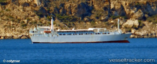
 Freedom
Current Status
Where is the vessel?
Freedom is currently in 13 nm S of Kumport, based on AIS data received about 1h ago.
Latest AIS update:
Current position: 40.72976° N, 28.82013° E (13 nm S of Kumport)
Average speed (last 7 days): Loading…
Average speed (last 30 days): Loading…
Vessel profile: Freedom is a Livestock Carrier with dimensions 87m x 16m.
This page combines live AIS, route history, probable destination signals, nearby traffic, and port activity for practical vessel monitoring.
The current position of vessel Freedom is 40.72976 lat / 28.82013 lng. Updated: 2026-03-28 13:28:57 UTCNearest reference points:
- 17 nm S of Kumport
- 16 nm S of Kumport
- Near Kumport
Currently sailing under the flag of Lebanon ![]()
Freedom built in 1971 year
Deadweight:
2794 tDetails:
Live Vessel Freedom Analytics (details, animations, etc.)
Recent AIS points (UTC):
2026-03-28 07:23:36 UTC · 40.80011, 28.65754 · SOG 0.7 kn · COG 188°2026-03-28 10:24:36 UTC · 40.73453, 28.79760 · SOG 0.4 kn · COG 158°
2026-03-28 11:50:56 UTC · 40.72761, 28.80644 · SOG 0.3 kn · COG 166°
2026-03-28 13:28:57 UTC · 40.72976, 28.82013 · SOG 0.5 kn · COG 190°