 vesseltracker.com
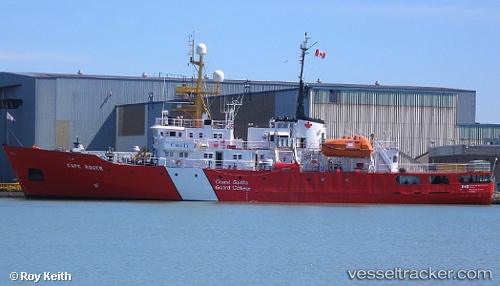
 Cape Roger
Current Status
Where is the vessel?
Cape Roger is currently in Near Edwardsville, based on AIS data received about 1h ago.
Latest AIS update:
Current position: 46.19667° N, 60.21333° W (Near Edwardsville)
Average speed (last 7 days): Loading…
Average speed (last 30 days): Loading…
Vessel profile: Cape Roger is a Fishing Support Vessel with dimensions m x m.
This page combines live AIS, route history, probable destination signals, nearby traffic, and port activity for practical vessel monitoring.
The current position of vessel Cape Roger is 46.19667 lat / -60.21333 lng. Updated: 2026-05-15 14:15:15 UTCNearest reference points:
- Near Goldboro
Currently sailing under the flag of Canada ![]()
Cape Roger built in 1977 year
Deadweight:
528 tDetails:
Live Vessel Cape Roger Analytics (details, animations, etc.)
Recent AIS points (UTC):
2026-05-15 10:20:50 UTC · 46.19645, -60.21233 · SOG 0.5 kn · COG 356°2026-05-15 11:59:50 UTC · 46.19613, -60.21191 · SOG 0.3 kn · COG 0°
2026-05-15 13:53:52 UTC · 46.19636, -60.21282 · SOG 0.8 kn · COG 13°
2026-05-15 14:15:15 UTC · 46.19667, -60.21333 · SOG 1 kn · COG -1°