 vesseltracker.com
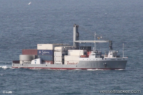
 Tropic Night
Current Status
Where is the vessel?
Tropic Night is currently in 61 nm NW of Abraham Bay, based on AIS data received less than 1h ago.
Latest AIS update:
Current position: 22.96167° N, 73.90667° W (61 nm NW of Abraham Bay)
Average speed (last 7 days): Loading…
Average speed (last 30 days): Loading…
Vessel profile: Tropic Night is a Landing Craft with dimensions 82m x 18m.
This page combines live AIS, route history, probable destination signals, nearby traffic, and port activity for practical vessel monitoring.
The current position of vessel Tropic Night is 22.96167 lat / -73.90667 lng. Updated: 2026-05-16 11:22:14 UTCNearest reference points:
- Near Great Exuma Island
- 47 nm SW of Cockburn Harbour
- 38 nm SW of Cockburn Harbour
Currently sailing under the flag of St Vincent Grenadines ![]()
Tropic Night built in 1976 year
Deadweight:
2333 tDetails:
Live Vessel Tropic Night Analytics (details, animations, etc.)
Recent AIS points (UTC):
2026-05-16 08:00:36 UTC · 22.47967, -73.54802 · SOG 10.7 kn · COG 307°2026-05-16 10:09:06 UTC · 22.78572, -73.77810 · SOG 10.9 kn · COG 321°
2026-05-16 10:19:13 UTC · 22.81167, -73.79167 · SOG 10 kn · COG -1°
2026-05-16 11:22:14 UTC · 22.96167, -73.90667 · SOG 10 kn · COG -1°