 vesseltracker.com
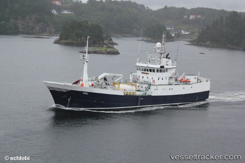
 Seivaag
Current Status
Where is the vessel?
Seivaag is currently in Near Fjelldal, based on AIS data received about 1h ago.
Latest AIS update:
Current position: 68.58374° N, 16.53878° E (Near Fjelldal)
Average speed (last 7 days): Loading…
Average speed (last 30 days): Loading…
Vessel profile: Seivaag is a Fish Carrier with dimensions 56m x 10m.
This page combines live AIS, route history, probable destination signals, nearby traffic, and port activity for practical vessel monitoring.
The current position of vessel Seivaag is 68.58374 lat / 16.53878 lng. Updated: 2026-05-15 15:34:28 UTCNearest reference points:
- Near Harstad
- Near Skrolsvik
- Near Sigerfjord
Currently sailing under the flag of Norway ![]()
Seivaag built in 1978 year
Deadweight:
900 tDetails:
Live Vessel Seivaag Analytics (details, animations, etc.)
Recent AIS points (UTC):
2026-05-15 11:45:58 UTC · 69.11126, 17.55757 · SOG 10.5 kn · COG 246°2026-05-15 13:10:26 UTC · 68.93218, 17.10005 · SOG 9.7 kn · COG 219°
2026-05-15 13:32:17 UTC · 68.88689, 16.99409 · SOG 9.9 kn · COG 219°
2026-05-15 15:34:28 UTC · 68.58374, 16.53878 · SOG 10.2 kn · COG 190°