 vesseltracker.com
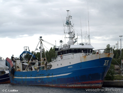
 Shemara
Current Status
Where is the vessel?
Shemara is currently in Near ROHUKULA, based on AIS data received less than 1h ago.
Latest AIS update:
Current position: 58.90514° N, 23.42484° E (Near ROHUKULA)
Average speed (last 7 days): Loading…
Average speed (last 30 days): Loading…
Vessel profile: Shemara is a Fishing Vessel with dimensions 38m x 8m.
This page combines live AIS, route history, probable destination signals, nearby traffic, and port activity for practical vessel monitoring.
The current position of vessel Shemara is 58.90514 lat / 23.42484 lng. Updated: 2026-05-15 14:00:17 UTCNearest reference points:
- Near Ristna
- Near Mahu Sadam
- Near Tvärminne
Currently sailing under the flag of Finland ![]()
Shemara built in 1980 year
Details:
Live Vessel Shemara Analytics (details, animations, etc.)
Recent AIS points (UTC):
2026-05-15 10:27:14 UTC · 58.90512, 23.42486 · SOG 0 kn · COG 331°2026-05-15 11:39:18 UTC · 58.90511, 23.42480 · SOG 0 kn · COG 332°
2026-05-15 13:39:19 UTC · 58.90516, 23.42485 · SOG 0 kn · COG 330°
2026-05-15 14:00:17 UTC · 58.90514, 23.42484 · SOG 0 kn · COG 330°