 vesseltracker.com
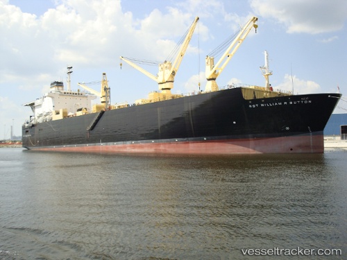
Us. Gov. Vessel
Current StatusWhere is the vessel?
Us. Gov. Vessel is currently in Near Blount Island, based on AIS data received less than 1h ago.
Latest AIS update:
Current position: 30.39990° N, 81.52530° W (Near Blount Island)
Average speed (last 7 days): Loading…
Average speed (last 30 days): Loading…
Vessel profile: Us. Gov. Vessel is a Vehicles Carrier with dimensions 32m x 205m.
This page combines live AIS, route history, probable destination signals, nearby traffic, and port activity for practical vessel monitoring.
The current position of vessel Us. Gov. Vessel is 30.39990 lat / -81.52530 lng. Updated: 2026-05-13 11:27:02 UTCNearest reference points:
- Near Jacksonville
- Near Fernandina
- Near Ponte Vedra
Details:
Live Vessel Us. Gov. Vessel Analytics (details, animations, etc.)
Recent AIS points (UTC):
2026-05-13 06:30:02 UTC · 30.39991, -81.52532 · SOG 0 kn · COG 123°2026-05-13 09:42:02 UTC · 30.39991, -81.52532 · SOG 0 kn · COG 123°
2026-05-13 10:27:04 UTC · 30.39991, -81.52531 · SOG 0 kn · COG 124°
2026-05-13 11:27:02 UTC · 30.39990, -81.52530 · SOG 0 kn · COG 123°