 vesseltracker.com
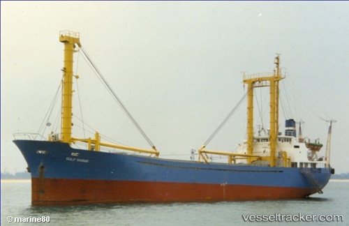
 GULF DAOUD
Current Status
Where is the vessel?
GULF DAOUD is currently in 76 nm E of Kumai, based on AIS data received about 1h ago.
Latest AIS update:
Current position: 2.54319° S, 112.96722° E (76 nm E of Kumai)
Average speed (last 7 days): Loading…
Average speed (last 30 days): Loading…
Vessel profile: GULF DAOUD is a General Cargo Ship with dimensions 12m x 89m.
This page combines live AIS, route history, probable destination signals, nearby traffic, and port activity for practical vessel monitoring.
The current position of vessel GULF DAOUD is -2.54319 lat / 112.96722 lng. Updated: 2026-04-08 12:39:12 UTCNearest reference points:
- 86 nm W of Taboneo
- Near BANJARMASIN
- Near Taboneo
Currently sailing under the flag of Indonesia ![]()
GULF DAOUD built in 1983 year
Deadweight:
2419 tDetails:
Live Vessel GULF DAOUD Analytics (details, animations, etc.)
Recent AIS points (UTC):
2026-04-08 08:07:12 UTC · -2.54281, 112.96727 · SOG 0.2 kn · COG -1°2026-04-08 09:29:02 UTC · -2.54305, 112.96711 · SOG 0 kn · COG -1°
2026-04-08 10:36:12 UTC · -2.54312, 112.96720 · SOG 0 kn · COG -1°
2026-04-08 12:39:12 UTC · -2.54319, 112.96722 · SOG 0 kn · COG -1°