 vesseltracker.com
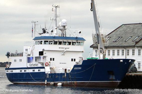
 Hydrograf
Current Status
Where is the vessel?
Hydrograf is currently in Near Skjervøy, based on AIS data received about 3h ago.
Latest AIS update:
Current position: 70.02888° N, 20.97442° E (Near Skjervøy)
Average speed (last 7 days): Loading…
Average speed (last 30 days): Loading…
Vessel profile: Hydrograf is a Buoy Lighthouse Vessel with dimensions 44m x 10m.
This page combines live AIS, route history, probable destination signals, nearby traffic, and port activity for practical vessel monitoring.
The current position of vessel Hydrograf is 70.02888 lat / 20.97442 lng. Updated: 2026-03-27 23:02:21 UTCNearest reference points:
- Near Skjervøy
- Near Sørkjosen
- Near SORVAR
Currently sailing under the flag of Norway ![]()
Hydrograf built in 1985 year
Deadweight:
454 tDetails:
Live Vessel Hydrograf Analytics (details, animations, etc.)
Recent AIS points (UTC):
2026-03-27 16:20:41 UTC · 70.02907, 20.97395 · SOG 1 kn · COG 182°2026-03-27 18:20:19 UTC · 70.02888, 20.97440 · SOG 0 kn · COG 226°
2026-03-27 21:48:22 UTC · 70.02888, 20.97440 · SOG 0 kn · COG 226°
2026-03-27 23:02:21 UTC · 70.02888, 20.97442 · SOG 0 kn · COG 227°