 vesseltracker.com
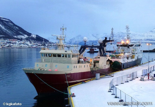
Kallista
Current StatusWhere is the vessel?
Kallista is currently in 27 nm NE of Dobrenice, based on AIS data received less than 1h ago.
Latest AIS update:
Current position: 51.75167° N, 155.09833° E (27 nm NE of Dobrenice)
Average speed (last 7 days): Loading…
Average speed (last 30 days): Loading…
Vessel profile: Kallista is a Fishing Vessel with dimensions 10m x 47m.
This page combines live AIS, route history, probable destination signals, nearby traffic, and port activity for practical vessel monitoring.
The current position of vessel Kallista is 51.75167 lat / 155.09833 lng. Updated: 2026-04-24 07:33:11 UTCNearest reference points:
- 30 nm NE of Dobrenice
- 13 nm SW of Ozernovskiy
- Near Severo-Kurilsk
Details:
Live Vessel Kallista Analytics (details, animations, etc.)
Recent AIS points (UTC):
2026-04-24 03:30:15 UTC · 51.68333, 155.27167 · SOG 4 kn · COG -1°2026-04-24 04:27:13 UTC · 51.69833, 155.21667 · SOG 2 kn · COG -1°
2026-04-24 05:21:09 UTC · 51.71667, 155.17667 · SOG 1 kn · COG -1°
2026-04-24 07:33:11 UTC · 51.75167, 155.09833 · SOG 0 kn · COG -1°