 vesseltracker.com
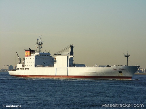
 Cala Pevero
Current Status
Where is the vessel?
Cala Pevero is currently in 117 nm S of Grobogan, based on AIS data received less than 1h ago.
Latest AIS update:
Current position: 5.22667° N, 110.91667° E (117 nm S of Grobogan)
Average speed (last 7 days): Loading…
Average speed (last 30 days): Loading…
Vessel profile: Cala Pevero is a Refrigerated Cargo Ship with dimensions 135m x 20m.
This page combines live AIS, route history, probable destination signals, nearby traffic, and port activity for practical vessel monitoring.
The current position of vessel Cala Pevero is 5.22667 lat / 110.91667 lng. Updated: 2026-05-15 17:34:29 UTCNearest reference points:
- 42 nm W of BINTULU
- 34 nm SE of Ranai
- 28 nm SW of BINTULU
Currently sailing under the flag of Curacao ![]()
Cala Pevero built in 1990 year
Deadweight:
6704 tDetails:
Live Vessel Cala Pevero Analytics (details, animations, etc.)
Recent AIS points (UTC):
2026-05-15 13:28:28 UTC · 5.78667, 111.70167 · SOG 14 kn · COG -1°2026-05-15 15:43:30 UTC · 5.47667, 111.27333 · SOG 13 kn · COG -1°
2026-05-15 16:49:30 UTC · 5.32833, 111.06167 · SOG 14 kn · COG -1°
2026-05-15 17:34:29 UTC · 5.22667, 110.91667 · SOG 14 kn · COG -1°