 vesseltracker.com
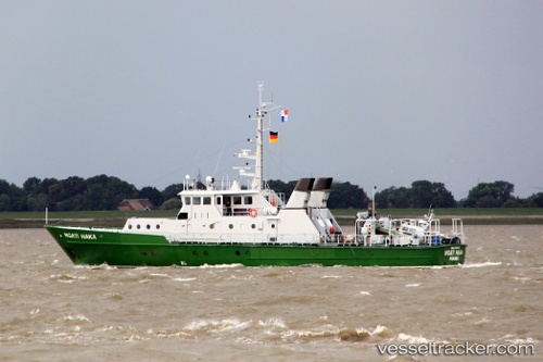
Ngati Haka
Current StatusWhere is the vessel?
Ngati Haka is currently in 80 nm E of MOCIMBOA DA PRAIA, based on AIS data received about 3h ago.
Latest AIS update:
Current position: 10.85330° S, 41.63504° E (80 nm E of MOCIMBOA DA PRAIA)
Average speed (last 7 days): Loading…
Average speed (last 30 days): Loading…
Vessel profile: Ngati Haka is a Offshore Support Vessel with dimensions 8m x 38m.
This page combines live AIS, route history, probable destination signals, nearby traffic, and port activity for practical vessel monitoring.
The current position of vessel Ngati Haka is -10.85330 lat / 41.63504 lng. Updated: 2026-05-15 04:32:35 UTCNearest reference points:
- Near Mtwara
- 64 nm NE of Mtwara
- 47 nm NW of Mohéli Apt
Details:
Live Vessel Ngati Haka Analytics (details, animations, etc.)
Recent AIS points (UTC):
2026-05-15 02:20:22 UTC · -10.94989, 41.82885 · SOG 5.6 kn · COG -1°2026-05-15 02:20:22 UTC · -10.94989, 41.82885 · SOG 5.6 kn · COG -1°
2026-05-15 04:32:35 UTC · -10.85330, 41.63504 · SOG 5.4 kn · COG -1°
2026-05-15 04:32:35 UTC · -10.85330, 41.63504 · SOG 5.4 kn · COG -1°