 vesseltracker.com
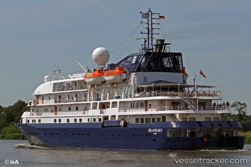
 Island Sky
Current Status
Where is the vessel?
Island Sky is currently in Near Hakusan, based on AIS data received about 1h ago.
Latest AIS update:
Current position: 36.60853° N, 136.61528° E (Near Hakusan)
Average speed (last 7 days): Loading…
Average speed (last 30 days): Loading…
Vessel profile: Island Sky is a Cruise Ship with dimensions 90m x 14m.
This page combines live AIS, route history, probable destination signals, nearby traffic, and port activity for practical vessel monitoring.
The current position of vessel Island Sky is 36.60853 lat / 136.61528 lng. Updated: 2026-05-16 14:23:11 UTCNearest reference points:
- Near Toyama
- Near Nagoya
- Near Yokkaichi
Currently sailing under the flag of Bahamas ![]()
Island Sky built in 1992 year
Deadweight:
695 tDetails:
Live Vessel Island Sky Analytics (details, animations, etc.)
Recent AIS points (UTC):
2026-05-16 10:41:08 UTC · 36.60851, 136.61526 · SOG 0 kn · COG 104°2026-05-16 12:05:09 UTC · 36.60851, 136.61528 · SOG 0 kn · COG 104°
2026-05-16 13:17:15 UTC · 36.60833, 136.61501 · SOG 0 kn · COG -1°
2026-05-16 14:23:11 UTC · 36.60853, 136.61528 · SOG 0 kn · COG 104°