 vesseltracker.com
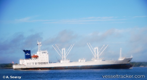
 ATLANTIC ROSE
Current Status
Where is the vessel?
ATLANTIC ROSE is currently in 127 nm NE of Belmonte, based on AIS data received about 4d ago.
Latest AIS update:
Current position: 14.94362° S, 36.92475° W (127 nm NE of Belmonte)
Average speed (last 7 days): Loading…
Average speed (last 30 days): Loading…
Vessel profile: ATLANTIC ROSE is a Reefer with dimensions m x m.
This page combines live AIS, route history, probable destination signals, nearby traffic, and port activity for practical vessel monitoring.
The current position of vessel ATLANTIC ROSE is -14.94362 lat / -36.92475 lng. Updated: 2026-05-11 08:30:15 UTCCurrently sailing under the flag of Saint Kitts and Nevis ![]()
Details:
Live Vessel ATLANTIC ROSE Analytics (details, animations, etc.)
Recent AIS points (UTC):
2026-05-11 08:30:15 UTC · -14.94362, -36.92475 · SOG 14.8 kn · COG 24°2026-05-11 08:30:15 UTC · -14.94362, -36.92475 · SOG 14.8 kn · COG 24°
2026-05-11 08:30:15 UTC · -14.94362, -36.92475 · SOG 14.8 kn · COG 24°
2026-05-11 08:30:15 UTC · -14.94362, -36.92475 · SOG 14.8 kn · COG 24°