 vesseltracker.com
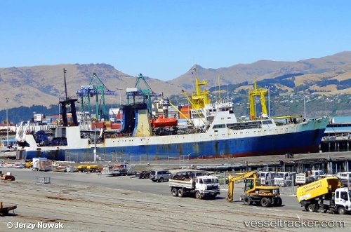
Irvinga
Current StatusWhere is the vessel?
Irvinga is currently in Near Lyttelton, based on AIS data received less than 1h ago.
Latest AIS update:
Current position: 43.60567° S, 172.72002° E (Near Lyttelton)
Average speed (last 7 days): Loading…
Average speed (last 30 days): Loading…
Vessel profile: Irvinga is a Fishing Vessel with dimensions 16m x 102m.
This page combines live AIS, route history, probable destination signals, nearby traffic, and port activity for practical vessel monitoring.
The current position of vessel Irvinga is -43.60567 lat / 172.72002 lng. Updated: 2026-05-16 13:59:18 UTCNearest reference points:
- Near Timaru
- Near Renwick
- Near Nelson
Details:
Live Vessel Irvinga Analytics (details, animations, etc.)
Recent AIS points (UTC):
2026-05-16 10:23:15 UTC · -43.60566, 172.72002 · SOG 0 kn · COG 215°2026-05-16 11:39:18 UTC · -43.60500, 172.71832 · SOG 0 kn · COG -1°
2026-05-16 13:08:19 UTC · -43.60561, 172.72000 · SOG 0 kn · COG 215°
2026-05-16 13:59:18 UTC · -43.60567, 172.72002 · SOG 0 kn · COG 215°