 vesseltracker.com
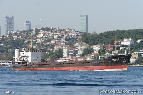
 ONUR
ONUR
Current Status
Where is the vessel?
ONUR is currently in Near ZEYTINBURNU, based on AIS data received less than 1h ago.
Latest AIS update:
Current position: 40.96062° N, 28.89877° E (Near ZEYTINBURNU)
Average speed (last 7 days): Loading…
Average speed (last 30 days): Loading…
Vessel profile: ONUR is a General Cargo with dimensions m x m.
This page combines live AIS, route history, probable destination signals, nearby traffic, and port activity for practical vessel monitoring.
The current position of vessel ONUR is 40.96062 lat / 28.89877 lng. Updated: 2026-04-25 16:39:55 UTCNearest reference points:
- Near BAKIRKOY
- Near ZEYTINBURNU
- Near Davutpasa
Currently sailing under the flag of Saint Kitts and Nevis ![]()
Details:
Live Vessel ONUR Analytics (details, animations, etc.)
Recent AIS points (UTC):
2026-04-25 13:00:42 UTC · 40.95528, 28.89267 · SOG 0.1 kn · COG -1°2026-04-25 14:27:56 UTC · 40.96077, 28.89872 · SOG 0 kn · COG -1°
2026-04-25 16:02:44 UTC · 40.95665, 28.89435 · SOG 0 kn · COG -1°
2026-04-25 16:39:55 UTC · 40.96062, 28.89877 · SOG 0.2 kn · COG -1°