 vesseltracker.com
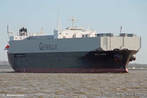
 Grouse Arrow
Current Status
Where is the vessel?
Grouse Arrow is currently in 56 nm SE of Langsa Venture FPSO, based on AIS data received about 12h ago.
Latest AIS update:
Current position: 4.90700° N, 98.89193° E (56 nm SE of Langsa Venture FPSO)
Average speed (last 7 days): Loading…
Average speed (last 30 days): Loading…
Vessel profile: Grouse Arrow is a Multi Purpose Carrier with dimensions 185m x 30m.
This page combines live AIS, route history, probable destination signals, nearby traffic, and port activity for practical vessel monitoring.
The current position of vessel Grouse Arrow is 4.90700 lat / 98.89193 lng. Updated: 2026-05-15 04:19:36 UTCNearest reference points:
- 43 nm NE of PANGKALAN SUSU
- 18 nm E of Langsa Venture FPSO
- 43 nm NE of Perbaungan
Currently sailing under the flag of Bahamas ![]()
Grouse Arrow built in 1991 year
Deadweight:
42276 tDetails:
Live Vessel Grouse Arrow Analytics (details, animations, etc.)
Recent AIS points (UTC):
2026-05-15 04:19:36 UTC · 4.90700, 98.89193 · SOG 12.1 kn · COG 320°2026-05-15 04:19:36 UTC · 4.90700, 98.89193 · SOG 12.1 kn · COG 320°
2026-05-15 04:19:36 UTC · 4.90700, 98.89193 · SOG 12.1 kn · COG 320°
2026-05-15 04:19:36 UTC · 4.90700, 98.89193 · SOG 12.1 kn · COG 320°