 vesseltracker.com
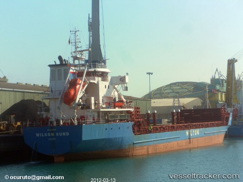
 WILSON SUND
Current Status
Where is the vessel?
WILSON SUND is currently in Near Ferrol, based on AIS data received less than 1h ago.
Latest AIS update:
Current position: 43.55666° N, 8.38409° W (Near Ferrol)
Average speed (last 7 days): Loading…
Average speed (last 30 days): Loading…
Vessel profile: WILSON SUND is a General Cargo with dimensions m x m.
This page combines live AIS, route history, probable destination signals, nearby traffic, and port activity for practical vessel monitoring.
The current position of vessel WILSON SUND is 43.55666 lat / -8.38409 lng. Updated: 2026-05-12 20:06:19 UTCNearest reference points:
- Near Ferrol
- Near La Coruna
- Near Milladoiro
Currently sailing under the flag of Bahamas ![]()
Details:
Live Vessel WILSON SUND Analytics (details, animations, etc.)
Recent AIS points (UTC):
2026-05-12 16:20:20 UTC · 43.36183, -8.38833 · SOG 0.1 kn · COG 300°2026-05-12 17:59:20 UTC · 43.36184, -8.38839 · SOG 0 kn · COG 300°
2026-05-12 19:14:16 UTC · 43.40583, -8.36933 · SOG 11.9 kn · COG 3°
2026-05-12 20:06:19 UTC · 43.55666, -8.38409 · SOG 10.2 kn · COG 1°