 vesseltracker.com
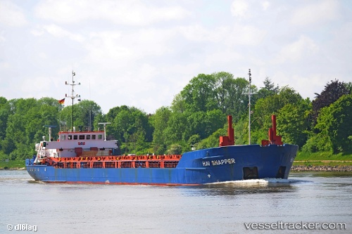
 Hav Snapper
Current Status
Where is the vessel?
Hav Snapper is currently in 15 nm NW of Schoorl, based on AIS data received less than 1h ago.
Latest AIS update:
Current position: 52.86513° N, 4.27402° E (15 nm NW of Schoorl)
Average speed (last 7 days): Loading…
Average speed (last 30 days): Loading…
Vessel profile: Hav Snapper is a Multi Purpose Carrier with dimensions 88m x 13m.
This page combines live AIS, route history, probable destination signals, nearby traffic, and port activity for practical vessel monitoring.
The current position of vessel Hav Snapper is 52.86513 lat / 4.27402 lng. Updated: 2026-05-13 01:20:04 UTCNearest reference points:
- 22 nm W of Schoorl
- Near Ijmuiden
- 23 nm N of de Ruyter
Currently sailing under the flag of Bahamas ![]()
Hav Snapper built in 1991 year
Deadweight:
2767 tDetails:
Live Vessel Hav Snapper Analytics (details, animations, etc.)
Recent AIS points (UTC):
2026-05-12 21:51:53 UTC · 52.48513, 3.69914 · SOG 8.7 kn · COG 40°2026-05-12 22:25:52 UTC · 52.54991, 3.78208 · SOG 9 kn · COG 45°
2026-05-12 23:29:20 UTC · 52.65252, 3.97927 · SOG 9.1 kn · COG 52°
2026-05-13 01:20:04 UTC · 52.86513, 4.27402 · SOG 9 kn · COG 26°