 vesseltracker.com
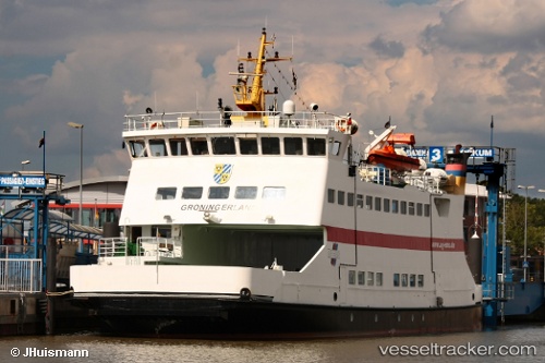
 Groningerland
Current Status
Where is the vessel?
Groningerland is currently in Near Pellworm, based on AIS data received less than 1h ago.
Latest AIS update:
Current position: 54.52142° N, 8.68717° E (Near Pellworm)
Average speed (last 7 days): Loading…
Average speed (last 30 days): Loading…
Vessel profile: Groningerland is a Passenger Ro Ro Cargo Ship with dimensions 45m x 45m.
This page combines live AIS, route history, probable destination signals, nearby traffic, and port activity for practical vessel monitoring.
The current position of vessel Groningerland is 54.52142 lat / 8.68717 lng. Updated: 2026-05-14 22:01:02 UTCNearest reference points:
- Near BUESUM
- Near Basel
- Near Kiel Canal
Currently sailing under the flag of Germany ![]()
Groningerland built in 1991 year
Deadweight:
133 tDetails:
Live Vessel Groningerland Analytics (details, animations, etc.)
Recent AIS points (UTC):
2026-05-14 17:26:03 UTC · 54.52142, 8.68720 · SOG 0 kn · COG 93°2026-05-14 19:45:22 UTC · 54.52136, 8.68725 · SOG 0 kn · COG 93°
2026-05-14 20:04:42 UTC · 54.52145, 8.68723 · SOG 0 kn · COG 93°
2026-05-14 22:01:02 UTC · 54.52142, 8.68717 · SOG 0 kn · COG 93°