 vesseltracker.com
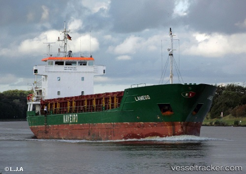
 RUSADER
Current Status
Where is the vessel?
RUSADER is currently in 17 nm W of LATAKIA, based on AIS data received less than 1h ago.
Latest AIS update:
Current position: 35.48071° N, 35.42149° E (17 nm W of LATAKIA)
Average speed (last 7 days): Loading…
Average speed (last 30 days): Loading…
Vessel profile: RUSADER is a General Cargo Ship with dimensions 88m x 13m.
This page combines live AIS, route history, probable destination signals, nearby traffic, and port activity for practical vessel monitoring.
The current position of vessel RUSADER is 35.48071 lat / 35.42149 lng. Updated: 2026-05-15 21:52:29 UTCNearest reference points:
- Near Al Latakia
- Near Al Ladhiqiyah
- Near Tartous
Currently sailing under the flag of Panama ![]()
RUSADER built in 1994 year
Deadweight:
3710 tDetails:
Live Vessel RUSADER Analytics (details, animations, etc.)
Recent AIS points (UTC):
2026-05-15 18:16:28 UTC · 35.00936, 35.38392 · SOG 8.7 kn · COG 2°2026-05-15 19:19:40 UTC · 35.15316, 35.39628 · SOG 8.1 kn · COG 356°
2026-05-15 19:29:09 UTC · 35.17412, 35.39739 · SOG 8 kn · COG 353°
2026-05-15 21:52:29 UTC · 35.48071, 35.42149 · SOG 7.1 kn · COG 11°