 vesseltracker.com
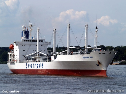
 RUNAWAY BAY
Current Status
Where is the vessel?
RUNAWAY BAY is currently in 14 nm SE of ARINAGA, based on AIS data received less than 1h ago.
Latest AIS update:
Current position: 27.64762° N, 15.26828° W (14 nm SE of ARINAGA)
Average speed (last 7 days): Loading…
Average speed (last 30 days): Loading…
Vessel profile: RUNAWAY BAY is a Refrigerated Cargo Ship with dimensions 20m x 149m.
This page combines live AIS, route history, probable destination signals, nearby traffic, and port activity for practical vessel monitoring.
The current position of vessel RUNAWAY BAY is 27.64762 lat / -15.26828 lng. Updated: 2026-05-13 12:05:47 UTCNearest reference points:
- Near TALIARTE
- Near Las Palmas de Gran Canaria
- Near Las Palmas
Currently sailing under the flag of Bahamas ![]()
RUNAWAY BAY built in 1992 year
Deadweight:
11579 tDetails:
Live Vessel RUNAWAY BAY Analytics (details, animations, etc.)
Recent AIS points (UTC):
2026-05-13 06:07:56 UTC · 28.07035, -15.38493 · SOG 0.1 kn · COG 5°2026-05-13 10:23:25 UTC · 28.05381, -15.34170 · SOG 11.7 kn · COG 129°
2026-05-13 10:44:28 UTC · 28.00455, -15.27510 · SOG 13.7 kn · COG 157°
2026-05-13 12:05:47 UTC · 27.64762, -15.26828 · SOG 15.8 kn · COG 179°