 vesseltracker.com
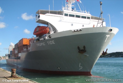
 Tropic Tide
Current Status
Where is the vessel?
Tropic Tide is currently in Near Nassau, based on AIS data received about 1h ago.
Latest AIS update:
Current position: 25.08427° N, 77.35693° W (Near Nassau)
Average speed (last 7 days): Loading…
Average speed (last 30 days): Loading…
Vessel profile: Tropic Tide is a Ro Ro Cargo Ship with dimensions 121m x 22m.
This page combines live AIS, route history, probable destination signals, nearby traffic, and port activity for practical vessel monitoring.
The current position of vessel Tropic Tide is 25.08427 lat / -77.35693 lng. Updated: 2026-05-13 13:21:55 UTCNearest reference points:
- Near Nassau
- Near Lyford Cay
- 11 nm S of Lyford Cay
Currently sailing under the flag of St Vincent Grenadines ![]()
Tropic Tide built in 1993 year
Deadweight:
7430 tDetails:
Live Vessel Tropic Tide Analytics (details, animations, etc.)
Recent AIS points (UTC):
2026-05-13 10:28:36 UTC · 25.51096, -77.57634 · SOG 12.4 kn · COG 158°2026-05-13 11:29:20 UTC · 25.32279, -77.47993 · SOG 12.4 kn · COG 153°
2026-05-13 13:18:51 UTC · 25.08428, -77.35692 · SOG 0.1 kn · COG 102°
2026-05-13 13:21:55 UTC · 25.08427, -77.35693 · SOG 0.1 kn · COG 102°