 vesseltracker.com
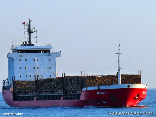
 Beata
Beata
Current Status
Where is the vessel?
Beata is currently in Near Trelleborg, based on AIS data received less than 1h ago.
Latest AIS update:
Current position: 55.23068° N, 13.17522° E (Near Trelleborg)
Average speed (last 7 days): Loading…
Average speed (last 30 days): Loading…
Vessel profile: Beata is a Multi Purpose Carrier with dimensions 107m x 18m.
This page combines live AIS, route history, probable destination signals, nearby traffic, and port activity for practical vessel monitoring.
The current position of vessel Beata is 55.23068 lat / 13.17522 lng. Updated: 2026-05-16 14:07:27 UTCNearest reference points:
- Near Trelleborg
- Near Oxie
- Near Skanör
Currently sailing under the flag of Portugal ![]()
Beata built in 1994 year
Deadweight:
6918 tDetails:
Live Vessel Beata Analytics (details, animations, etc.)
Recent AIS points (UTC):
2026-05-16 10:03:07 UTC · 55.71188, 12.68108 · SOG 10.2 kn · COG 180°2026-05-16 12:23:18 UTC · 55.30516, 12.63815 · SOG 10.7 kn · COG 150°
2026-05-16 14:00:57 UTC · 55.23320, 13.14082 · SOG 11 kn · COG 98°
2026-05-16 14:07:27 UTC · 55.23068, 13.17522 · SOG 10.9 kn · COG 98°