 vesseltracker.com
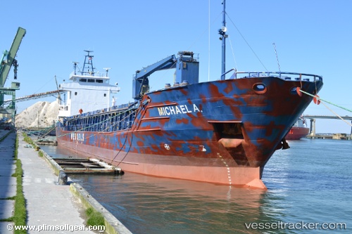
Michael A.
Current StatusWhere is the vessel?
Michael A. is currently in 20 nm NW of Moa, based on AIS data received about 1h ago.
Latest AIS update:
Current position: 20.96403° N, 75.05017° W (20 nm NW of Moa)
Average speed (last 7 days): Loading…
Average speed (last 30 days): Loading…
Vessel profile: Michael A. is a Multi Purpose Carrier with dimensions 13m x 88m.
This page combines live AIS, route history, probable destination signals, nearby traffic, and port activity for practical vessel monitoring.
The current position of vessel Michael A. is 20.96403 lat / -75.05017 lng. Updated: 2026-05-16 14:59:09 UTCNearest reference points:
- 16 nm SE of Ceiba Hueca
Details:
Live Vessel Michael A. Analytics (details, animations, etc.)
Recent AIS points (UTC):
2026-05-16 11:04:13 UTC · 21.18199, -75.61940 · SOG 9.3 kn · COG 113°2026-05-16 13:01:40 UTC · 21.06641, -75.32923 · SOG 8.8 kn · COG 111°
2026-05-16 13:01:40 UTC · 21.06641, -75.32923 · SOG 8.8 kn · COG 111°
2026-05-16 14:59:09 UTC · 20.96403, -75.05017 · SOG 8.2 kn · COG 107°