 vesseltracker.com
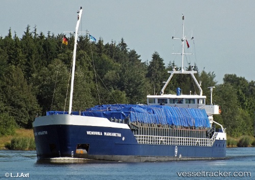
 Hendrika Margaretha
Current Status
Where is the vessel?
Hendrika Margaretha is currently in 16 nm SE of HELGOLAND, based on AIS data received less than 1h ago.
Latest AIS update:
Current position: 54.01071° N, 8.27327° E (16 nm SE of HELGOLAND)
Average speed (last 7 days): Loading…
Average speed (last 30 days): Loading…
Vessel profile: Hendrika Margaretha is a General Cargo Ship with dimensions 81m x 12m.
This page combines live AIS, route history, probable destination signals, nearby traffic, and port activity for practical vessel monitoring.
The current position of vessel Hendrika Margaretha is 54.01071 lat / 8.27327 lng. Updated: 2026-05-14 23:58:48 UTCNearest reference points:
- 10 nm E of Wangerooge
- Near BUESUM
- Near HOOKSIEL
Currently sailing under the flag of Netherlands ![]()
Hendrika Margaretha built in 1993 year
Deadweight:
3200 tDetails:
Live Vessel Hendrika Margaretha Analytics (details, animations, etc.)
Recent AIS points (UTC):
2026-05-14 20:02:02 UTC · 53.85178, 8.97071 · SOG 6 kn · COG 259°2026-05-14 22:01:09 UTC · 53.91002, 8.68812 · SOG 6.1 kn · COG 332°
2026-05-14 22:37:28 UTC · 53.96228, 8.61378 · SOG 7.6 kn · COG 293°
2026-05-14 23:58:48 UTC · 54.01071, 8.27327 · SOG 9.5 kn · COG 273°