 vesseltracker.com
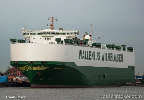
 TURANDOT
Current Status
Where is the vessel?
TURANDOT is currently in 49 nm NE of Zanzibar, based on AIS data received less than 1h ago.
Latest AIS update:
Current position: 5.73556° S, 39.87078° E (49 nm NE of Zanzibar)
Average speed (last 7 days): Loading…
Average speed (last 30 days): Loading…
Vessel profile: TURANDOT is a Vehicles Carrier with dimensions m x m.
This page combines live AIS, route history, probable destination signals, nearby traffic, and port activity for practical vessel monitoring.
The current position of vessel TURANDOT is -5.73556 lat / 39.87078 lng. Updated: 2026-04-29 19:26:45 UTCNearest reference points:
- Near Dar Es Salaam
- 11 nm SE of Mombasa
- Near Mombasa
Currently sailing under the flag of Sweden ![]()
Details:
Live Vessel TURANDOT Analytics (details, animations, etc.)
Recent AIS points (UTC):
2026-04-29 15:49:10 UTC · -6.74674, 39.37265 · SOG 17.6 kn · COG 64°2026-04-29 16:48:03 UTC · -6.59540, 39.62886 · SOG 18.8 kn · COG 43°
2026-04-29 17:28:00 UTC · -6.38840, 39.70547 · SOG 20.4 kn · COG 21°
2026-04-29 19:26:45 UTC · -5.73556, 39.87078 · SOG 20 kn · COG 17°