 vesseltracker.com
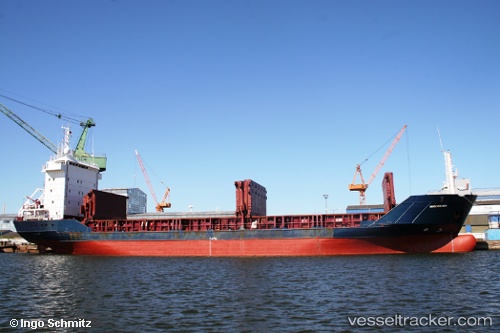
 ST. MARIA
Current Status
Where is the vessel?
ST. MARIA is currently in Near Constanta, based on AIS data received about 1h ago.
Latest AIS update:
Current position: 44.16257° N, 28.65714° E (Near Constanta)
Average speed (last 7 days): Loading…
Average speed (last 30 days): Loading…
Vessel profile: ST. MARIA is a General Cargo Ship with dimensions 100m x 16m.
This page combines live AIS, route history, probable destination signals, nearby traffic, and port activity for practical vessel monitoring.
The current position of vessel ST. MARIA is 44.16257 lat / 28.65714 lng. Updated: 2026-05-13 02:18:21 UTCNearest reference points:
- Near Constanta
- Near MIDIA
- Near Ovidiu
Currently sailing under the flag of St.Kitts and Nevis ![]()
ST. MARIA built in 1994 year
Deadweight:
4766 tDetails:
Live Vessel ST. MARIA Analytics (details, animations, etc.)
Recent AIS points (UTC):
2026-05-12 22:28:46 UTC · 44.16255, 28.65714 · SOG 0 kn · COG 8°2026-05-12 23:35:38 UTC · 44.16255, 28.65715 · SOG 0 kn · COG 8°
2026-05-13 01:29:03 UTC · 44.16257, 28.65715 · SOG 0 kn · COG 8°
2026-05-13 02:18:21 UTC · 44.16257, 28.65714 · SOG 0 kn · COG 8°