 vesseltracker.com
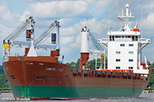
 Qamutik
Current Status
Where is the vessel?
Qamutik is currently in Near Champlain, based on AIS data received about 176d ago.
Latest AIS update:
Current position: 46.40410° N, 72.38085° W (Near Champlain)
Average speed (last 7 days): Loading…
Average speed (last 30 days): Loading…
Vessel profile: Qamutik is a Multi Purpose Carrier with dimensions 137m x 19m.
This page combines live AIS, route history, probable destination signals, nearby traffic, and port activity for practical vessel monitoring.
The current position of vessel Qamutik is 46.40410 lat / -72.38085 lng. Updated: 2025-11-19 17:00:11 UTCNearest reference points:
- Near Cap-de-la-Madeleine
- Near Verchères
- Near QUEBEC
Currently sailing under the flag of Netherlands ![]()
Qamutik built in 1994 year
Deadweight:
12760 tDetails:
Live Vessel Qamutik Analytics (details, animations, etc.)
Recent AIS points (UTC):
2025-11-19 17:00:11 UTC · 46.40410, -72.38085 · SOG 0 kn · COG 52°