 vesseltracker.com
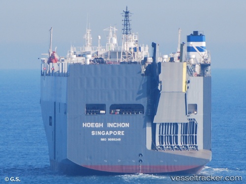
 PELAGIC PIRANHA
Current Status
Where is the vessel?
PELAGIC PIRANHA is currently in 11 nm S of Conakry Eco, based on AIS data received about 1h ago.
Latest AIS update:
Current position: 9.31279° N, 13.68660° W (11 nm S of Conakry Eco)
Average speed (last 7 days): Loading…
Average speed (last 30 days): Loading…
Vessel profile: PELAGIC PIRANHA is a Vehicles Carrier with dimensions 32m x 180m.
This page combines live AIS, route history, probable destination signals, nearby traffic, and port activity for practical vessel monitoring.
The current position of vessel PELAGIC PIRANHA is 9.31279 lat / -13.6866 lng. Updated: 2026-03-28 19:49:59 UTCNearest reference points:
- Near Conakry
- 28 nm S of Conakry
- Near NASSIT
Currently sailing under the flag of Malta ![]()
PELAGIC PIRANHA built in 1997 year
Deadweight:
12490 tDetails:
Live Vessel PELAGIC PIRANHA Analytics (details, animations, etc.)
Recent AIS points (UTC):
2026-03-28 14:05:00 UTC · 9.31294, -13.68680 · SOG 0 kn · COG 230°2026-03-28 16:13:59 UTC · 9.31304, -13.68670 · SOG 0 kn · COG 256°
2026-03-28 18:23:00 UTC · 9.31309, -13.68670 · SOG 0 kn · COG 284°
2026-03-28 19:49:59 UTC · 9.31279, -13.68660 · SOG 0.1 kn · COG 315°