 vesseltracker.com
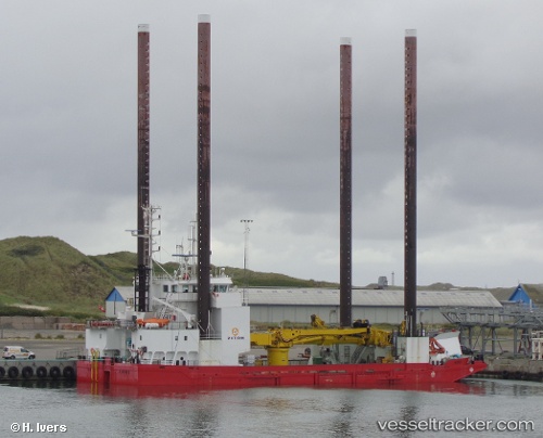
 Wind
Wind
Current Status
Where is the vessel?
Wind is currently in Near Klagshamn, based on AIS data received less than 1h ago.
Latest AIS update:
Current position: 55.51258° N, 12.78074° E (Near Klagshamn)
Average speed (last 7 days): Loading…
Average speed (last 30 days): Loading…
Vessel profile: Wind is a Service Ship with dimensions 55m x 18m.
This page combines live AIS, route history, probable destination signals, nearby traffic, and port activity for practical vessel monitoring.
The current position of vessel Wind is 55.51258 lat / 12.78074 lng. Updated: 2026-05-15 21:45:26 UTCNearest reference points:
- Near Skanör
- Near Limhamn
- Near Malmo
Currently sailing under the flag of Denmark ![]()
Wind built in 1996 year
Deadweight:
1463 tDetails:
Live Vessel Wind Analytics (details, animations, etc.)
Recent AIS points (UTC):
2026-05-15 17:51:25 UTC · 55.51250, 12.78096 · SOG 0.1 kn · COG 40°2026-05-15 19:06:18 UTC · 55.51260, 12.78078 · SOG 0 kn · COG 40°
2026-05-15 19:54:24 UTC · 55.51260, 12.78078 · SOG 0 kn · COG 40°
2026-05-15 21:45:26 UTC · 55.51258, 12.78074 · SOG 0 kn · COG 40°