 vesseltracker.com
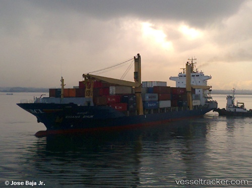
 YUNEX
YUNEX
Current Status
Where is the vessel?
YUNEX is currently in Near Choa Chu Kang, based on AIS data received less than 1h ago.
Latest AIS update:
Current position: 1.27966° N, 103.90101° E (Near Choa Chu Kang)
Average speed (last 7 days): Loading…
Average speed (last 30 days): Loading…
Vessel profile: YUNEX is a Container Ship with dimensions m x m.
This page combines live AIS, route history, probable destination signals, nearby traffic, and port activity for practical vessel monitoring.
The current position of vessel YUNEX is 1.27966 lat / 103.90101 lng. Updated: 2026-05-15 13:14:17 UTCNearest reference points:
- Near Tampines
- Near Choa Chu Kang
- Near Changi
Currently sailing under the flag of Panama ![]()
Details:
Live Vessel YUNEX Analytics (details, animations, etc.)
Recent AIS points (UTC):
2026-05-15 10:20:14 UTC · 1.27945, 103.90164 · SOG 0.2 kn · COG 208°2026-05-15 10:56:17 UTC · 1.27965, 103.90140 · SOG 0.4 kn · COG 198°
2026-05-15 11:37:10 UTC · 1.27937, 103.90057 · SOG 0.1 kn · COG 158°
2026-05-15 13:14:17 UTC · 1.27966, 103.90101 · SOG 0.1 kn · COG 179°