 vesseltracker.com
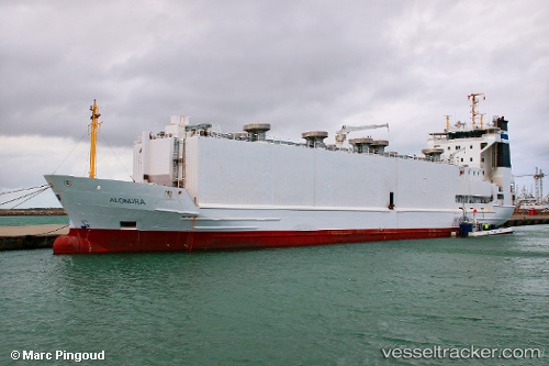
 ALONDRA
Current Status
Where is the vessel?
ALONDRA is currently in 22 nm NW of Fernando De Noronha, based on AIS data received less than 1h ago.
Latest AIS update:
Current position: 3.65470° S, 32.74390° W (22 nm NW of Fernando De Noronha)
Average speed (last 7 days): Loading…
Average speed (last 30 days): Loading…
Vessel profile: ALONDRA is a Livestock Carrier with dimensions 97m x 16m.
This page combines live AIS, route history, probable destination signals, nearby traffic, and port activity for practical vessel monitoring.
The current position of vessel ALONDRA is -3.65470 lat / -32.74390 lng. Updated: 2026-05-16 16:05:26 UTCNearest reference points:
- 20 nm E of Natal
Currently sailing under the flag of Denmark (DIS) ![]()
ALONDRA built in 1995 year
Deadweight:
2796 tDetails:
Live Vessel ALONDRA Analytics (details, animations, etc.)
Recent AIS points (UTC):
2026-05-16 13:46:29 UTC · -3.20486, -32.61998 · SOG 12.2 kn · COG 196°2026-05-16 14:03:20 UTC · -3.25854, -32.63876 · SOG 11.9 kn · COG 193°
2026-05-16 16:04:43 UTC · -3.65167, -32.74333 · SOG 11 kn · COG -1°
2026-05-16 16:05:26 UTC · -3.65470, -32.74390 · SOG 12 kn · COG 183°