 vesseltracker.com
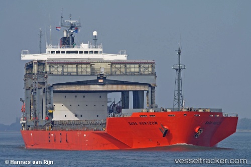
 SAGA HORIZON
Current Status
Where is the vessel?
SAGA HORIZON is currently in 31 nm SE of Flekkerøy, based on AIS data received about 1h ago.
Latest AIS update:
Current position: 57.69457° N, 8.62005° E (31 nm SE of Flekkerøy)
Average speed (last 7 days): Loading…
Average speed (last 30 days): Loading…
Vessel profile: SAGA HORIZON is a General Cargo with dimensions m x m.
This page combines live AIS, route history, probable destination signals, nearby traffic, and port activity for practical vessel monitoring.
The current position of vessel SAGA HORIZON is 57.69457 lat / 8.62005 lng. Updated: 2026-04-27 23:40:00 UTCNearest reference points:
- 27 nm N of HANSTHOLM
- 28 nm NW of Lokken
- Near HANSTHOLM
Currently sailing under the flag of Bahamas ![]()
Details:
Live Vessel SAGA HORIZON Analytics (details, animations, etc.)
Recent AIS points (UTC):
2026-04-27 20:14:39 UTC · 57.18579, 7.75116 · SOG 11.8 kn · COG 39°2026-04-27 22:06:00 UTC · 57.46660, 8.23097 · SOG 12.4 kn · COG 49°
2026-04-27 22:50:29 UTC · 57.56624, 8.42384 · SOG 12.1 kn · COG 34°
2026-04-27 23:40:00 UTC · 57.69457, 8.62005 · SOG 12 kn · COG 41°