 vesseltracker.com
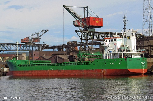
 WALES
WALES
Current Status
Where is the vessel?
WALES is currently in 18 nm W of CHIPIONA, based on AIS data received about 1h ago.
Latest AIS update:
Current position: 36.70204° N, 6.79210° W (18 nm W of CHIPIONA)
Average speed (last 7 days): Loading…
Average speed (last 30 days): Loading…
Vessel profile: WALES is a General Cargo with dimensions m x m.
This page combines live AIS, route history, probable destination signals, nearby traffic, and port activity for practical vessel monitoring.
The current position of vessel WALES is 36.70204 lat / -6.79210 lng. Updated: 2026-05-18 05:48:44 UTCNearest reference points:
- Near CHIPIONA
- Near Punta Umbría
- Near Cadiz
Currently sailing under the flag of Bahamas ![]()
Details:
Live Vessel WALES Analytics (details, animations, etc.)
Recent AIS points (UTC):
2026-05-18 01:34:04 UTC · 36.36042, -6.52395 · SOG 5.2 kn · COG 329°2026-05-18 03:23:55 UTC · 36.50149, -6.63031 · SOG 5.6 kn · COG 329°
2026-05-18 03:23:55 UTC · 36.50149, -6.63031 · SOG 5.6 kn · COG 329°
2026-05-18 05:48:44 UTC · 36.70204, -6.79210 · SOG 6.1 kn · COG 349°