 vesseltracker.com
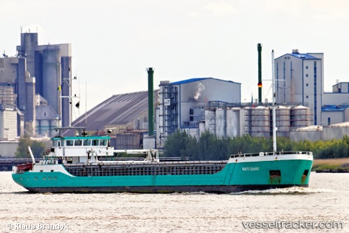
 Waterway
Current Status
Where is the vessel?
Waterway is currently in Near KOLOBRZEG, based on AIS data received about 1h ago.
Latest AIS update:
Current position: 54.18058° N, 15.55446° E (Near KOLOBRZEG)
Average speed (last 7 days): Loading…
Average speed (last 30 days): Loading…
Vessel profile: Waterway is a General Cargo Ship with dimensions 81m x 10m.
This page combines live AIS, route history, probable destination signals, nearby traffic, and port activity for practical vessel monitoring.
The current position of vessel Waterway is 54.18058 lat / 15.55446 lng. Updated: 2026-05-12 19:57:42 UTCNearest reference points:
- Near KOLOBRZEG
- 31 nm NW of Ustka
- Near TEJN
Currently sailing under the flag of St Vincent Grenadines ![]()
Waterway built in 1996 year
Deadweight:
1454 tDetails:
Live Vessel Waterway Analytics (details, animations, etc.)
Recent AIS points (UTC):
2026-05-12 17:00:51 UTC · 54.18044, 15.55465 · SOG 0 kn · COG 320°2026-05-12 18:09:51 UTC · 54.18047, 15.55459 · SOG 0 kn · COG 320°
2026-05-12 19:21:42 UTC · 54.18059, 15.55443 · SOG 0 kn · COG 321°
2026-05-12 19:57:42 UTC · 54.18058, 15.55446 · SOG 0 kn · COG 319°