 vesseltracker.com
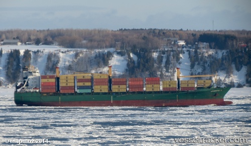
 SHENTON WAY
Current Status
Where is the vessel?
SHENTON WAY is currently in 43 nm SW of Veraval, based on AIS data received less than 1h ago.
Latest AIS update:
Current position: 20.42130° N, 69.79482° E (43 nm SW of Veraval)
Average speed (last 7 days): Loading…
Average speed (last 30 days): Loading…
Vessel profile: SHENTON WAY is a Container Ship with dimensions m x m.
This page combines live AIS, route history, probable destination signals, nearby traffic, and port activity for practical vessel monitoring.
The current position of vessel SHENTON WAY is 20.42130 lat / 69.79482 lng. Updated: 2026-05-16 02:21:30 UTCNearest reference points:
- 33 nm S of Mul Dwårka
- 54 nm S of Positra
- 49 nm S of Positra
Currently sailing under the flag of Panama ![]()
Details:
Live Vessel SHENTON WAY Analytics (details, animations, etc.)
Recent AIS points (UTC):
2026-05-15 22:06:20 UTC · 20.13040, 70.74180 · SOG 13.5 kn · COG 290°2026-05-15 23:33:53 UTC · 20.23333, 70.41167 · SOG 14 kn · COG -1°
2026-05-16 00:57:40 UTC · 20.32962, 70.09870 · SOG 13 kn · COG 289°
2026-05-16 02:21:30 UTC · 20.42130, 69.79482 · SOG 12.7 kn · COG 288°