 vesseltracker.com
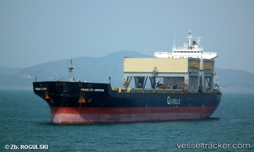
 Penguin Arrow
Current Status
Where is the vessel?
Penguin Arrow is currently in 10 nm E of Jingjiang, based on AIS data received less than 1h ago.
Latest AIS update:
Current position: 31.00500° N, 122.60500° E (10 nm E of Jingjiang)
Average speed (last 7 days): Loading…
Average speed (last 30 days): Loading…
Vessel profile: Penguin Arrow is a Multi Purpose Carrier with dimensions 200m x 32m.
This page combines live AIS, route history, probable destination signals, nearby traffic, and port activity for practical vessel monitoring.
The current position of vessel Penguin Arrow is 31.00500 lat / 122.60500 lng. Updated: 2026-05-14 17:35:21 UTCNearest reference points:
- 14 nm N of Lü-hua Shan
- Near Lü-hua Shan
- 19 nm NE of Lü-hua Shan
Currently sailing under the flag of Bahamas ![]()
Penguin Arrow built in 1997 year
Deadweight:
55506 tDetails:
Live Vessel Penguin Arrow Analytics (details, animations, etc.)
Recent AIS points (UTC):
2026-05-14 14:03:38 UTC · 31.00878, 122.60105 · SOG 0.3 kn · COG 157°2026-05-14 15:45:38 UTC · 31.00800, 122.60320 · SOG 0.1 kn · COG 207°
2026-05-14 16:57:39 UTC · 31.00645, 122.60383 · SOG 0 kn · COG 239°
2026-05-14 17:35:21 UTC · 31.00500, 122.60500 · SOG 0 kn · COG -1°