 vesseltracker.com
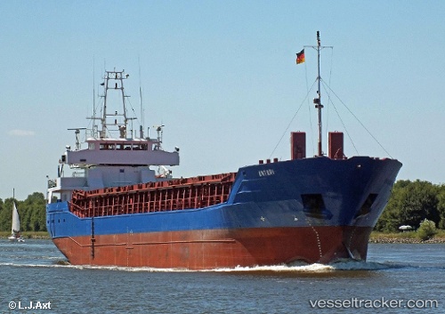
 ANTARI
Current Status
Where is the vessel?
ANTARI is currently in 27 nm SW of Thirasía, based on AIS data received less than 1h ago.
Latest AIS update:
Current position: 36.12787° N, 24.92852° E (27 nm SW of Thirasía)
Average speed (last 7 days): Loading…
Average speed (last 30 days): Loading…
Vessel profile: ANTARI is a General Cargo Ship with dimensions 13m x 87m.
This page combines live AIS, route history, probable destination signals, nearby traffic, and port activity for practical vessel monitoring.
The current position of vessel ANTARI is 36.12787 lat / 24.92852 lng. Updated: 2026-03-29 17:45:04 UTCNearest reference points:
- Near Iraklion
- Near PISO LIVADI
- 17 nm W of Milos (Adamas)
Currently sailing under the flag of Barbados ![]()
ANTARI built in 1998 year
Deadweight:
3700 tDetails:
Live Vessel ANTARI Analytics (details, animations, etc.)
Recent AIS points (UTC):
2026-03-29 12:09:22 UTC · 36.17758, 25.84319 · SOG 7.8 kn · COG 265°2026-03-29 14:20:35 UTC · 36.15942, 25.49130 · SOG 8.3 kn · COG 268°
2026-03-29 15:45:58 UTC · 36.14520, 25.25548 · SOG 8.3 kn · COG 263°
2026-03-29 17:45:04 UTC · 36.12787, 24.92852 · SOG 8 kn · COG 270°