 vesseltracker.com
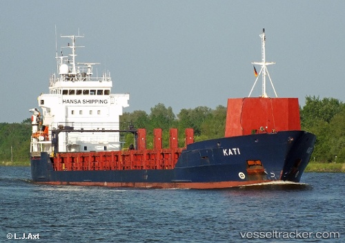
 KATI
KATI
Current Status
Where is the vessel?
KATI is currently in 17 nm W of Boboras, based on AIS data received about 2h ago.
Latest AIS update:
Current position: 46.51667° N, 8.51833° W (17 nm W of Boboras)
Average speed (last 7 days): Loading…
Average speed (last 30 days): Loading…
Vessel profile: KATI is a General Cargo Ship with dimensions 107m x 107m.
This page combines live AIS, route history, probable destination signals, nearby traffic, and port activity for practical vessel monitoring.
The current position of vessel KATI is 46.51667 lat / -8.51833 lng. Updated: 2026-03-27 22:00:24 UTCNearest reference points:
- 57 nm S of Boboras
- 58 nm SE of Rietheim-Weilheim
- 60 nm SE of San Clodio
Currently sailing under the flag of Antigua and Barbuda ![]()
KATI built in 1998 year
Deadweight:
5145 tDetails:
Live Vessel KATI Analytics (details, animations, etc.)
Recent AIS points (UTC):
2026-03-27 16:18:24 UTC · 47.62667, -7.98167 · SOG 12 kn · COG -1°2026-03-27 17:27:25 UTC · 47.39833, -8.08667 · SOG 12 kn · COG -1°
2026-03-27 20:03:24 UTC · 46.89833, -8.33667 · SOG 12 kn · COG -1°
2026-03-27 22:00:24 UTC · 46.51667, -8.51833 · SOG 12 kn · COG -1°