 vesseltracker.com
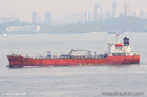
 ULTRA ENERGY
Current Status
Where is the vessel?
ULTRA ENERGY is currently in 241 nm N of Anewa Bay, based on AIS data received about 1h ago.
Latest AIS update:
Current position: 2.38122° S, 156.79527° E (241 nm N of Anewa Bay)
Average speed (last 7 days): Loading…
Average speed (last 30 days): Loading…
Vessel profile: ULTRA ENERGY is a Oil Products Tanker with dimensions 20m x 108m.
This page combines live AIS, route history, probable destination signals, nearby traffic, and port activity for practical vessel monitoring.
The current position of vessel ULTRA ENERGY is -2.38122 lat / 156.79527 lng. Updated: 2026-05-13 10:25:13 UTCCurrently sailing under the flag of Panama ![]()
ULTRA ENERGY built in 1999 year
Deadweight:
6688 tDetails:
Live Vessel ULTRA ENERGY Analytics (details, animations, etc.)
Recent AIS points (UTC):
2026-05-13 06:07:10 UTC · -1.99795, 157.52782 · SOG 11.8 kn · COG 239°2026-05-13 07:26:09 UTC · -2.11543, 157.30530 · SOG 11.4 kn · COG 240°
2026-05-13 09:37:09 UTC · -2.31010, 156.93050 · SOG 11.4 kn · COG 239°
2026-05-13 10:25:13 UTC · -2.38122, 156.79527 · SOG 11.5 kn · COG 244°