 vesseltracker.com
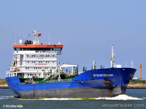
 STENSTRAUM
Current Status
Where is the vessel?
STENSTRAUM is currently in 54 nm NE of PENGERANG, based on AIS data received about 1h ago.
Latest AIS update:
Current position: 1.89366° N, 104.87097° E (54 nm NE of PENGERANG)
Average speed (last 7 days): Loading…
Average speed (last 30 days): Loading…
Vessel profile: STENSTRAUM is a Oil/Chemical Tanker with dimensions m x m.
This page combines live AIS, route history, probable destination signals, nearby traffic, and port activity for practical vessel monitoring.
The current position of vessel STENSTRAUM is 1.89366 lat / 104.87097 lng. Updated: 2026-05-15 06:14:08 UTCNearest reference points:
- 53 nm NE of PENGERANG
- 51 nm NE of PENGERANG
- 55 nm NE of PENGERANG
Currently sailing under the flag of Liberia ![]()
Details:
Live Vessel STENSTRAUM Analytics (details, animations, etc.)
Recent AIS points (UTC):
2026-05-14 23:45:20 UTC · 1.22932, 103.95541 · SOG 11.1 kn · COG 74°2026-05-15 04:21:00 UTC · 1.60571, 104.70195 · SOG 10.7 kn · COG 47°
2026-05-15 04:33:09 UTC · 1.62939, 104.72970 · SOG 10.7 kn · COG 49°
2026-05-15 06:14:08 UTC · 1.89366, 104.87097 · SOG 10.9 kn · COG 18°