 vesseltracker.com
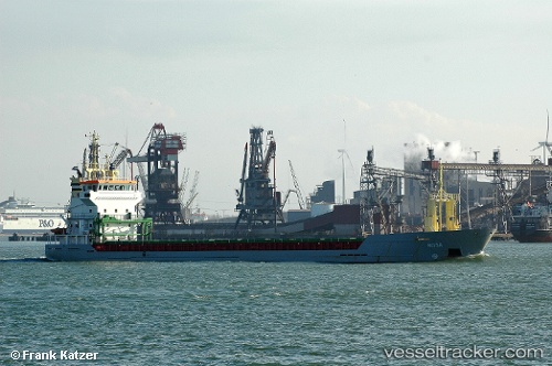
 KETTER
Current Status
Where is the vessel?
KETTER is currently in Near Hull, based on AIS data received about 1h ago.
Latest AIS update:
Current position: 53.73297° N, 0.35452° W (Near Hull)
Average speed (last 7 days): Loading…
Average speed (last 30 days): Loading…
Vessel profile: KETTER is a General Cargo with dimensions 95m x 13m.
This page combines live AIS, route history, probable destination signals, nearby traffic, and port activity for practical vessel monitoring.
The current position of vessel KETTER is 53.73297 lat / -0.35452 lng. Updated: 2026-05-15 03:43:48 UTCNearest reference points:
- Near Hull
- Near Hessle/Hull
- Near Immingham
Currently sailing under the flag of Malta ![]()
KETTER built in 2000 year
Deadweight:
5050 tDetails:
ex Taha
Live Vessel KETTER Analytics (details, animations, etc.)
Recent AIS points (UTC):
2026-05-14 22:58:49 UTC · 53.73294, -0.35455 · SOG 0 kn · COG 62°2026-05-14 23:47:29 UTC · 53.73295, -0.35454 · SOG 0 kn · COG 62°
2026-05-15 01:10:50 UTC · 53.73296, -0.35451 · SOG 0 kn · COG 62°
2026-05-15 03:43:48 UTC · 53.73297, -0.35452 · SOG 0 kn · COG 62°